What is a Grey Line Map in Amateur Radio?
What is a Grey Line Map in Amateur Radio?
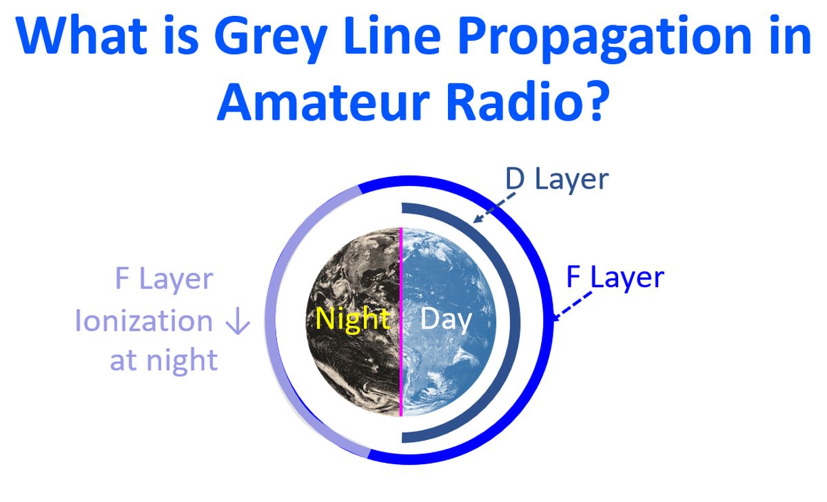
Grey line is a transition line coinciding with twilight zone where a change in the propagation of radio waves is observed. Grey line propagation provides surprisingly long distance communications at dawn and dusk. From India, the greatest distance across the globe will be the United States of America, which is almost on the other side of the globe for us. It was possible to work United States from India on 40 m, which is usually taken as a band for local contacts, during grey line propagation period in the morning and evening. I have myself experienced this when I used to work DX on CX in late 1980s. We had only a short window in the morning and evening to work W land. It is also convenient for operators on both sides because both are likely to be awake in this period usually.
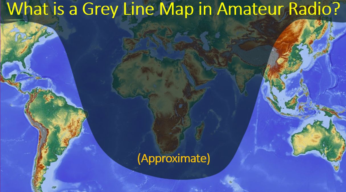
There is an online grey line map which refreshes every five minutes at QSL Net webpage. It has been mentioned there that propagation along grey line is very efficient.
We can observe the movement of the shadow region on the webpage and try to optimise communication to the appropriate region of the globe as the shadow moves across the globe. That is the advantage of having a live grey line map available online. In LEO satellite communication, if you can find out the current location of the satellite from tracking program, it is possible to know whether the satellite is being illuminated or not. There are some satellites like AO-91 with weak batteries, which will work only while illuminated and you are not supposed to use the voice transponder while in eclipse.